Keynote Speaker |
|
Associate Dean, School of Engg and Technology Coordinator, Remote Sensing and GIS Editor-in-Chief, International Journal of Geoinformatics Asian Institute of Technology |
Title |
| Artificial Neural Network for Snow Cover Forecasting |
Abstract |
| Global warming will impact the extent, amount and duration of snow cover in the Himalayas. IPCC 2007 and ICIMOD reports 2007 have brought a great wave in the world with their forecasting: the Himalayas glaciers will disappear by the end of 2035. The results of these studies and many more are unanimous and have indicated a general decline in the snow with projected warming. However, change are not consistent in all of these studies and many previous studies have overestimated the resulting impact of climate change. With increasing trends in temperature and decreasing trends in winter precipitation, a significant negative trend in snow cover areas was identified in the last decade and this trend is likely to continue in the future based on forecasting precipitation and temperature. Results clearly indicate the impact of global warming on snow cover area in the Himalayas. We use an artificial neural network to calculate the snow cover in Kaligandaki river basins with four zones. We use the past climate scenario and snow cover area to train, validate and test the model that captures the gross features of snow under the current climate. We assess the range of likely effects of climate change on seasonal snow in Himalaya using downscaled temperature and precipitation changes from the (A1B) climate change projections from HadCM3 model. We consider the time period from 2011 to 2040. There is a reduction between 9 to 46% of snow cover in different elevation zone. Zone II and Zone III are the most affected zones whereas zone IV is the least effected. However, from the analysis it is clear that seasonal snow in Kaligandaki basin is likely to be subject to substantial change due to the impacts of climate change. |
Invited Speaker |
Patrick Doherty. |
Title |
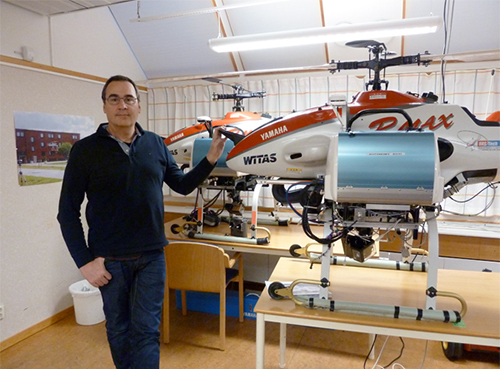
| Leveraging KR Techniques in Autonomous Unmanned Aircraft Systems |
Abstract |
In this talk I will describe a number of autonomous unmanned aircraft systems we have developed and used as research platforms during the past decade. A major focus of our research effort has been to push AI technologies into fully deployed unmanned aircraft systems. I will show how we have leveraged different knowledge representation systems and integrated them into our platforms. Particular systems that will be discussed are automated temporal planning systems, execution monitoring systems, stream-based reasoning systems and frameworks for cooperative robotics based on delegation. Use of these techniques will be demonstrated in diverse emergency services applications using both single and multiple platform scenarios. Both simulated and actual missions will be shown. |
Special Session Speaker |
|
Nguyen Kim Loi. |
Title |
| Online Supporting System Flood Warning and Climate Change in the Central Vietnam |
Abstract |
Vu Gia watershed is located in the Central Vietnam where hurricanes represent a constant natural threat to human lives and physical infrastructure. Hydrological monitoring is considered as an effective tool to respond to high flood events by preventing and mitigating damages. The purpose of this study was to conduct and perform hydrological modeling to determine areas prone to be flooded during high rainfall events in the upstream Vu Gia watershed. The methodology involved: hydro-climatic data base building, a detailed Digital Elevation Model (DEM), a land use cover, and a soil map of the basin. With all this data, the SWAT model (Soil and Water Assessment Tool) was used to predict discharge values. These discharge values were used, along with the DEM, to predict flood hazard areas in the downstream of Vu Gia watershed floodplains. This procedure was made using the HECRAS model (Hydrological Engineering Center-River Analysis System). Finals results show the exact location of areas with high, moderate and low risk to be flooded at specific high flood events. The results also provided the location of critical areas, so that an early warning system can be located. Additionally, as a part of this study, valuable information was provided to at-risk residents about how to prevent and mitigate the effect of flood-related damages in low land areas of the Vu Gia watershed. |
MIWAI'12
The 6th Multi-Disciplinary International Workshop on Artificial Intelligence


 1
1 1
1 2
2 3
3 4
4 5
5
